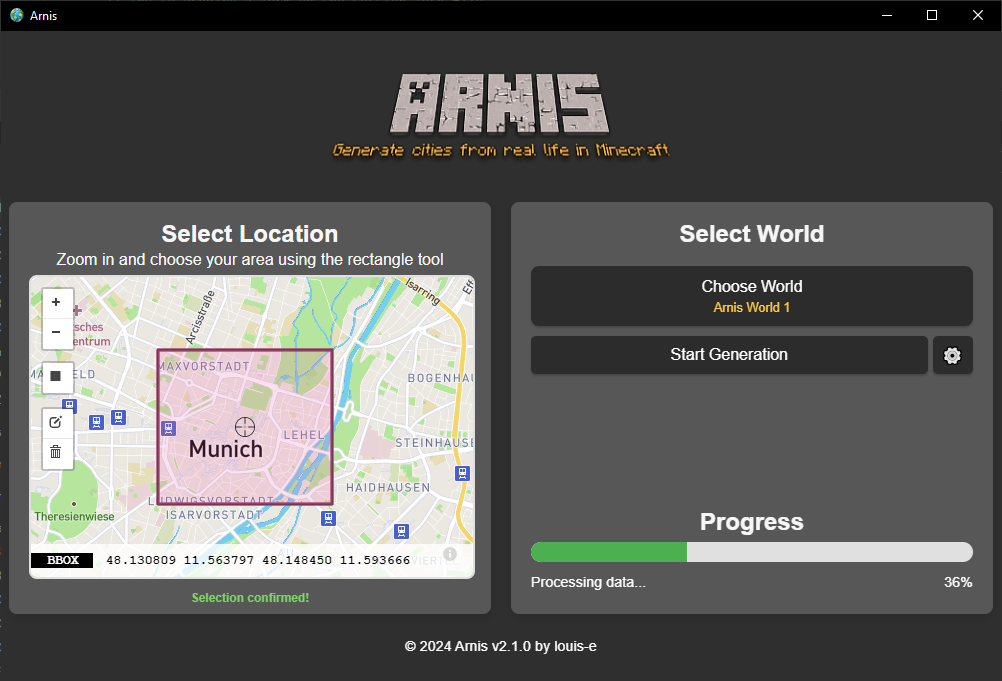
Arnis: Transform Real World Locations into Minecraft Worlds

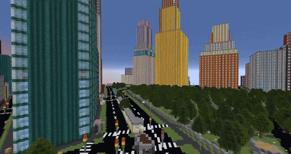
Experience the power of Arnis, the revolutionary tool that brings real-world geography into Minecraft. Whether you want to explore your hometown, recreate famous landmarks, or build in accurate city environments, Arnis makes it possible with precise detail and efficient generation.

arnis

What is Arnis?

Arnis is a powerful open-source project that bridges the gap between real-world geography and Minecraft. Using advanced geospatial data from OpenStreetMap and the robust capabilities of Rust programming, Arnis creates accurate and detailed Minecraft worlds that reflect real-world locations.

The Arnis project is continuously evolving, with regular updates and improvements driven by a passionate community of contributors. From generating city landscapes to recreating natural features, Arnis offers unprecedented accuracy and detail in bringing real-world locations into Minecraft.

How to use Arnis?

Generate your first real-world location in Minecraft with these simple steps

How to use arnis
  1. Download and Install

    Get started by downloading Arnis for your platform. The tool is available for Windows, macOS, and Linux systems.

  2. Select Your Location

    Use Arnis's intuitive interface to select any area in the world you want to generate. The rectangle tool makes it easy to define your desired region.

  3. Generate Your World

    Click 'Start Generation' and watch as Arnis transforms your selected location into a detailed Minecraft world. The generation starts at coordinates 0,0,0 in your Minecraft world.

Key Features of Arnis

Discover what makes Arnis the leading tool for generating real-world locations in Minecraft

What others say about Arnis

Arnis has received positive feedback from users, with many praising its accuracy and ease of use. Here are some of the comments from satisfied users.

Frequently Asked Questions About Arnis

  1. What exactly is Arnis?

    Arnis is an open-source tool that generates real-world locations in Minecraft Java Edition using OpenStreetMap data. It creates detailed replicas of buildings, roads, and landscapes with high accuracy.

  2. Which Minecraft versions are supported?

    Arnis works best with Minecraft version 1.21.4. Support for versions 1.16.5 and below is currently in development.

  3. How do I select an area to generate?

    Use the rectangle tool in Arnis to select your desired area on the map. The selected area will be generated starting from coordinates 0,0,0 in your Minecraft world.

  4. Do I need an existing Minecraft world?

    Yes, currently you need to create a new flat world in Minecraft before using Arnis. The tool will generate the structures in your selected world.

  5. Where does Arnis get its data?

    Arnis uses geospatial data from OpenStreetMap, a collaborative mapping project that provides detailed geographic data worldwide.

  6. Can I contribute to Arnis?

    Absolutely! Arnis is open-source and welcomes contributions. You can contribute through code, bug reports, or feature suggestions on GitHub.

  7. Why is my generated world empty?

    Make sure to teleport to the generation starting point (/tp 0 0 0). If still empty, try exploring in the positive X and Z directions.

  8. How accurate are the generated structures?

    Arnis creates highly detailed structures based on OpenStreetMap data, maintaining accurate proportions and layouts while adapting them to Minecraft's block-based system.

  9. Is Arnis free to use?

    Yes, Arnis is completely free and open-source under the GNU General Public License v3.0.

  10. What are the system requirements for Arnis?

    Arnis runs on modern Windows, macOS, and Linux systems. For Windows users, the Microsoft Evergreen Bootstrapper is required.

Download Arnis

Version: New Year's Resolution Update (v2.1.3)
Released on Jan 8, 2025

💻 View on GitHub